Services
High Range Dynamic Laser Scanning / BIM
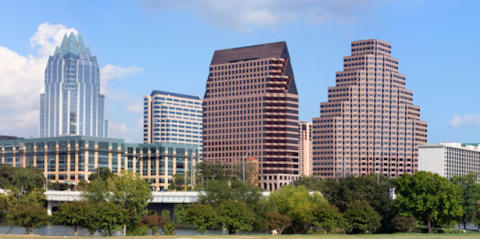
Delta Land Surveying is one of the few land surveying firms in Texas to offer HDR 3D Laser Scanning services. A 3D Laser Scanner collects literally millions of data points during a scan and each point has a specific coordinate which allows measurements to be derived between points with up to a 2 mm +/- accuracy. Additionally all of these points are combined into what is referred to as a point cloud from which virtual 3D models can be created for design purposes. The 3D Scanner employed by Delta Land Surveying goes beyond simply collecting dense clouds of points in a number of ways that other scanners my not: (1) Our 3D Scanner uses a Class 1 laser which is safe for the eyes of individuals in the scanning range, (2) Our 3D Scanner has a “High Dynamic Range” (HDR) camera which can take color photographs up to 170 mega-pixels even in bright or low light conditions and these colors are then assigned to each scan point resulting in a realistic view of the point cloud and (3) Our 3D Scanner uses phase shift measurement technology which allows it to take multiple measurements on each scan point for greater accuracy.HDR 3D Laser Scanning can make your next project more efficient and profitable.
Reduce time and errors by: 1. Reducing the number of and the liability associated with manual measurement errors. 2. Reducing the time of on-site inspections. 3. Providing advanced interference and clash detection for new installations and upgrades without the need for return trips to the site. Improve planning and design by: 1. Improving overall design processes by creating as-built drawings and models where none previously existed. 2. Analyzing engineering design plans, checking for clashes between existing conditions and new design elements and evaluating alternatives before projects costs are committed. 3. Allowing designs to be more efficient, accurate and effective by permitting immediate processing of the data in all commonly used CAD programs such as Civil 3D, Revit, Rhino, Bentley Microstation and many others. Improve work processes by: 1. Providing consistent as-built documentation for CAD/design specifications for project layout. 2. Updating existing documentation of site conditions including existing piping and instrumentation diagrams. 3. Evaluating existing pipe runs and facilities for regulatory compliance requirements. 4. Visualizing construction plans prior to execution. 5. Providing exact dimensions for demolition and removal of project components in existing facilities. 6. Accommodating scope changes more intelligently by providing the ability to examine “what if …” scenarios quickly and with confidence. Reduce project costs by: 1. Reducing outage and construction schedules for revamp, modification and upgrade projects. 2. Reducing the total installed cost for brownfield projects by 5 – 7 percent. 3. Allowing work flows to be more cost effective by using more comprehensive data than provided by traditional surveying methods. 4. Reducing design errors by discovering clashes with existing conditions such as re-routing piping in the design process instead of cutting and welding new in the field. 5. Creating better construction sequencing and coordination of the removal of large vessels, demolition of existing piping, structures and concrete. 6. Reducing the number of contingencies in contracts for change orders. 7. Bids submitted on designs based on accurate as-built data will reduce the number of change orders on a project and allow those required to be handled in a more flexible manner. 8. Reducing the number of on-site visits required for data collection. 9. Archiving massive amount of data for usability on future projects can reduce the need for resurveys and repetitive work thereby increasing productivity. Increase safety by: 1. Limiting the time required to collect data in complex and dangerous environments. 2. Allowing accurate data to be collected remotely from hard to access areas without erecting scaffolding or employing precarious techniques required by traditional surveying methods. Reduce liability by: 1. Documenting existing damage to a site prior to beginning construction. 2. Filling in gaps between design and installed conditions by defining undocumented changes. 3. Photo-realistic point clouds allows engineers and architects to virtually visit the site from the office. 4. Increasing collaboration across multiple disciplines from project managers, engineering and design leads, fabrication, construction, operation and maintenance and project personnel. 5. Documenting that the work has been executed correctly as the construction proceeds and before components are hidden by walls or other components. 6. Documenting precise variance comparisons for final inspections. 7. Providing seamless monitoring of construction and documentation for the entire building life cycle. 8. Insures transparency and legal certainty for claim management.
DELTA LAND SURVEYING
© Delta Land Surveying - All Rights Reserved.
Texas Firm No. 10194017 - Oklahoma Firm No. 5405


Services
High Range Dynamic Laser
Scanning / BIM
Delta Land Surveying is one of the few land surveying firms in Texas to offer HDR 3D Laser Scanning services. A 3D Laser Scanner collects literally millions of data points during a scan and each point has a specific coordinate which allows measurements to be derived between points with up to a 2 mm +/- accuracy. Additionally all of these points are combined into what is referred to as a point cloud from which virtual 3D models can be created for design purposes. The 3D Scanner employed by Delta Land Surveying goes beyond simply collecting dense clouds of points in a number of ways that other scanners my not: (1) Our 3D Scanner uses a Class 1 laser which is safe for the eyes of individuals in the scanning range, (2) Our 3D Scanner has a “High Dynamic Range” (HDR) camera which can take color photographs up to 170 mega-pixels even in bright or low light conditions and these colors are then assigned to each scan point resulting in a realistic view of the point cloud and (3) Our 3D Scanner uses phase shift measurement technology which allows it to take multiple measurements on each scan point for greater accuracy.HDR 3D Laser Scanning can make your
next project more efficient and
profitable.
Reduce time and errors by: 1. Reducing the number of and the liability associated with manual measurement errors. 2. Reducing the time of on-site inspections. 3. Providing advanced interference and clash detection for new installations and upgrades without the need for return trips to the site. Improve planning and design by: 1. Improving overall design processes by creating as-built drawings and models where none previously existed. 2. Analyzing engineering design plans, checking for clashes between existing conditions and new design elements and evaluating alternatives before projects costs are committed. 3. Allowing designs to be more efficient, accurate and effective by permitting immediate processing of the data in all commonly used CAD programs such as Civil 3D, Revit, Rhino, Bentley Microstation and many others. Improve work processes by: 1. Providing consistent as-built documentation for CAD/design specifications for project layout. 2. Updating existing documentation of site conditions including existing piping and instrumentation diagrams. 3. Evaluating existing pipe runs and facilities for regulatory compliance requirements. 4. Visualizing construction plans prior to execution. 5. Providing exact dimensions for demolition and removal of project components in existing facilities. 6. Accommodating scope changes more intelligently by providing the ability to examine “what if …” scenarios quickly and with confidence. Reduce project costs by: 1. Reducing outage and construction schedules for revamp, modification and upgrade projects. 2. Reducing the total installed cost for brownfield projects by 5 – 7 percent. 3. Allowing work flows to be more cost effective by using more comprehensive data than provided by traditional surveying methods. 4. Reducing design errors by discovering clashes with existing conditions such as re-routing piping in the design process instead of cutting and welding new in the field. 5. Creating better construction sequencing and coordination of the removal of large vessels, demolition of existing piping, structures and concrete. 6. Reducing the number of contingencies in contracts for change orders. 7. Bids submitted on designs based on accurate as-built data will reduce the number of change orders on a project and allow those required to be handled in a more flexible manner. 8. Reducing the number of on-site visits required for data collection. 9. Archiving massive amount of data for usability on future projects can reduce the need for resurveys and repetitive work thereby increasing productivity. Increase safety by: 1. Limiting the time required to collect data in complex and dangerous environments. 2. Allowing accurate data to be collected remotely from hard to access areas without erecting scaffolding or employing precarious techniques required by traditional surveying methods. Reduce liability by: 1. Documenting existing damage to a site prior to beginning construction. 2. Filling in gaps between design and installed conditions by defining undocumented changes. 3. Photo-realistic point clouds allows engineers and architects to virtually visit the site from the office. 4. Increasing collaboration across multiple disciplines from project managers, engineering and design leads, fabrication, construction, operation and maintenance and project personnel. 5. Documenting that the work has been executed correctly as the construction proceeds and before components are hidden by walls or other components. 6. Documenting precise variance comparisons for final inspections. 7. Providing seamless monitoring of construction and documentation for the entire building life cycle. 8. Insures transparency and legal certainty for claim management.
DELTA LAND SURVEYING
© Delta Land Surveying - All Rights Reserved.
Texas Firm No. 10194017 - Oklahoma Firm No. 5405