Services
Right-of-way Survey
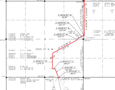
A right-of-way survey for a pipeline, roadway easement or overhead utility lines is conducted to establish an easement across a property for the construction and maintenance. The survey typically stakes all angle points of the easement and a stake approximately every 200 feet along the centerline. The survey plat will include an exhibit showing the relationship of the right-of-way to the property lines along with a metes and bounds description of the proposed easement. Usually a separate exhibit is prepared for each owner the proposed easement may cross. The exhibits and descriptions are included with the easement agreements and filed in the County Clerk’s Office.
DELTA LAND SURVEYING
© Delta Land Surveying - All Rights Reserved.
Texas Firm No. 10194017 - Oklahoma Firm No. 5405


Services
Right-of-way Survey
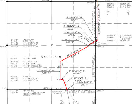
A right-of-way survey for a pipeline, roadway easement or overhead utility lines is conducted to establish an easement across a property for the construction and maintenance. The survey typically stakes all angle points of the easement and a stake approximately every 200 feet along the centerline. The survey plat will include an exhibit showing the relationship of the right- of-way to the property lines along with a metes and bounds description of the proposed easement. Usually a separate exhibit is prepared for each owner the proposed easement may cross. The exhibits and descriptions are included with the easement agreements and filed in the County Clerk’s Office.
DELTA LAND SURVEYING
© Delta Land Surveying - All Rights Reserved.
Texas Firm No. 10194017 - Oklahoma Firm No. 5405