Delta Land Surveying - All rights reserved.
Texas Firm Number: 10194017 | Oklahoma Firm Number: 5405
High Range Dynamic Laser Scanning / BIM
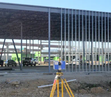
Delta Land Surveying is one of the few land surveying firms in Texas to offer HDR 3D Laser Scanning services. A 3D Laser Scanner collects literally millions of data points during a scan and each point has a specific coordinate which allows measurements to be derived between points with up to a 2 mm +/- accuracy. Additionally all of these points are combined into what is referred to as a point cloud from which virtual 3D models can be created for design purposes. The 3D Scanner employed by Delta Land Surveying goes beyond simply collecting dense clouds of points in a number of ways that other scanners my not: (1) Our 3D Scanner uses a Class 1 laser which is safe for the eyes of individuals in the scanning range, (2) Our 3D Scanner has a “High Dynamic Range” (HDR) camera which can take color photographs up to 170 mega-pixels even in bright or low light conditions and these colors are then assigned to each scan point resulting in a realistic view of the point cloud and (3) Our 3D Scanner uses phase shift measurement technology which allows it to take multiple measurements on each scan point for greater accuracy. HDR 3D Laser Scanning can make your next project more efficient and profitable

Delta Land Surveying - All rights reserved.
TX Firm #10194017 | OK Firm #5405
Delta Land Surveying

High Range Dynamic Laser Scanning / BIM
Delta Land Surveying is one of the few land surveying firms in Texas to offer HDR 3D Laser Scanning services. A 3D Laser Scanner collects literally millions of data points during a scan and each point has a specific coordinate which allows measurements to be derived between points with up to a 2 mm +/- accuracy. Additionally all of these points are combined into what is referred to as a point cloud from which virtual 3D models can be created for design purposes. The 3D Scanner employed by Delta Land Surveying goes beyond simply collecting dense clouds of points in a number of ways that other scanners my not: (1) Our 3D Scanner uses a Class 1 laser which is safe for the eyes of individuals in the scanning range, (2) Our 3D Scanner has a “High Dynamic Range” (HDR) camera which can take color photographs up to 170 mega-pixels even in bright or low light conditions and these colors are then assigned to each scan point resulting in a realistic view of the point cloud and (3) Our 3D Scanner uses phase shift measurement technology which allows it to take multiple measurements on each scan point for greater accuracy. HDR 3D Laser Scanning can make your next project more efficient and profitable
Delta Land Surveying


